|
The Skipper Kent Collection Books SOLD! |
|
|
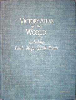
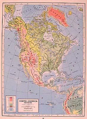
1943 Victory Atlas of the World including Battle Maps of All Fronts by Hammond's World Atlas and Gazetteer published by C.S. Hammond and Co. New York Excellent piece of World War 2 memorabilia, with 32 color maps of the world, 6 black and white world economic maps, and many statistics on population, major cities, and geography.
|
dimensions: 9 1/2 wide x 12 1/4 high inches 48 pages
Very Good overall condition with no dust jacket. Minor wear from age and use. A few small paper tears along outside of binding. Illustrations and maps in very good condition. Pages clean and bright. |
|
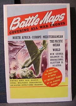
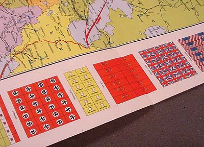
Fold-out full color battle map included in paper pocket inside back cover. Map shows areas of Japanese and Nazi influence, and allied advances from 1939 to 1943. Printed just before D-Day.
|
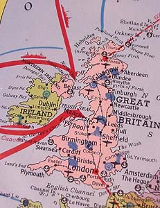
Fold-out includes battle maps for North Africa, Europe, the Mediterranean, and the Pacific theatre including the Solomon Islands, Guadalcanal, Aleutian Islands and Alaska. Map details include Allied and Axis battle lines and areas of occupation, naval and air bases and resources, supply lines and more!
|
|
Battle map also includes sheets of cut-out flags for pin-mounting, used to follow the "tides of battle" on the map. |
|
|
for inquiries email info@galwest.com |
|
All pages on this web site are copyright 1998 to 2016 by Williams Gallery West